
Flowing across the rugged Deccan Plateau, the Tungabhadra River carries a character very different from forest-fed rivers of the Western Ghats. Here, water does not glide gently through dense greenery — it presses, turns, and reshapes a hard, rocky landscape through force and persistence.
The defining feature of the Tungabhadra is its dramatic bends. These curves are not accidents of geography but outcomes of resistance — where water negotiates with rock, slope, and sediment. Each bend tells a story of erosion, settlement, and survival. This editorial exploration looks at six powerful river bends that reveal how the Tungabhadra river shapes both land and life.
Table of Contents
1. Upper Plateau Bends: Water Against Stone
In its upper stretches, the Tungabhadra river cuts across hard granite formations. The river bends sharply here, forced to change direction as it encounters resistant rock layers.
These bends are zones of intense erosion. Over centuries, the river scours rock faces, deepening channels and widening curves. The land yields slowly, proving that even the hardest terrain can be reshaped by persistent flow.
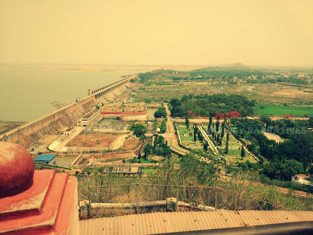
2. Hampi Bend: Where River and Civilization Converged
One of the most historically significant bends of the Tungabhadra river lies near Hampi. The river’s curve created natural boundaries, fertile floodplains, and defensive advantages that supported the Vijayanagara Empire.
This bend shows how river dynamics influence human settlement. While the river offered its resources generously, it also demanded respect — seasonal floods and shifting banks shaped how the city expanded and survived.

3. Mid-Course Meanders: Fertility Born from Movement
As the river enters gentler slopes, its bends widen into pronounced meanders. Here, erosion occurs on the outer banks, while sediments are deposited on the inner curves.
These processes create fertile soil that sustains agriculture along the river’s edge. At the same time, farmland remains vulnerable to shifting channels, reminding communities that life near a river is always provisional.
4. Rocky Gorge Curves: Power Contained
In narrower sections, the Tungabhadra river bends through rocky gorges where water accelerates and energy concentrates. These curves are loud, fast, and forceful.
Such bends demonstrate the river’s raw power. They limit vegetation, restrict human access, and emphasize dominance over cooperation — a reminder that rivers do not always nurture gently.
5. Downstream Reservoir Influences: Altered Bends, Altered Balance
Dams and reservoirs along the Tungabhadra river have softened some bends while intensifying others. Altered flow patterns reduce natural sediment movement, changing how the river interacts with its banks.
These changes affect agriculture, fisheries, and riverbank stability. The bends still exist, but their natural rhythm has been disrupted — shaping the land in new, often unpredictable ways.
6. Lower Course Curves: Where Strength Begins to Thin
In its lower reaches, the Tungabhadra’s bends become broader and slower. The river spreads wider, losing some of its cutting force but maintaining influence through seasonal flooding.
Here, the land shows layers of past interactions — abandoned channels, fertile plains, and eroded banks — evidence of a river that has repeatedly rewritten its course over time.
How River Bends Shape Life Along the Tungabhadra river
The bends of the Tungabhadra determine:
- Where soil accumulates
- Where villages form or retreat
- How crops survive dry seasons
- How ecosystems adapt to changing flow
Life along the river is shaped not by straight lines, but by curves — each bend offering opportunity and risk in equal measure.
Human Dependence and Natural Limits
Communities along the Tungabhadra rely heavily on its waters, yet the river’s plateau setting leaves little margin for error. Reduced flow, over-extraction, and altered sediment cycles amplify pressure on an already demanding landscape.
The bends continue to guide life, but they also reveal the limits of control in a system built on movement and change.
A River That Shapes — Even as It Is Constrained
The Tungabhadra does not sculpt forests quietly or carve caves invisibly. It reshapes the land openly, through force, resistance, and time. Its bends stand as records of negotiation between water and stone, life and limitation.
Within the broader story of forest and river landscapes shaped by water and time, the Tungabhadra represents the harder edge of this relationship — where survival depends not on abundance, but on adaptation.